Derbyshire County Councillors have voted in favour of reinstating the railway along the Monsal Trail rather than approve the electric tram proposal from Blackwell into Buxton. Madness!
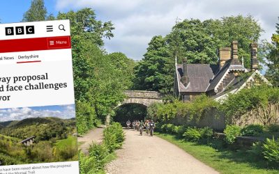
Derbyshire County Councillors have voted in favour of reinstating the railway along the Monsal Trail rather than approve the electric tram proposal from Blackwell into Buxton. Madness!
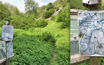
The Peak District National Park’s plan to open a new cycle hire centre in the old goods shed at Miller’s Dale Station has come in for a lot of criticism from both visitors and local businesses.
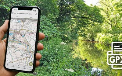
GPX files of all the walks featured on this website are now available to purchase for just £1.50 each. I’ve also included a guide to choosing and using one of the many popular walking apps now available.
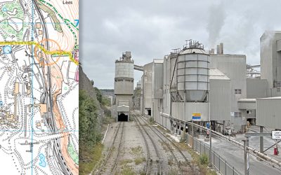
Lying just a few miles east of Buxton, Tunstead is the largest limestone quarry in the UK. And its railway could provide the much-needed link between the Monsal Trail and Buxton.
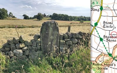
Lying close to Robin Hood’s Stride, the Grey Ladies Stone Circle once boasted nine standing stones. Five have been removed over the millennia, but the four remaining are the tallest in Derbyshire.
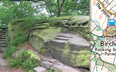
The bizarre carvings at Rowtor Rocks – including thrones, altars, steps and prehistoric-style symbols – are the work of an eccentric Birchover Rector who also seems to have been a practicing Druid.
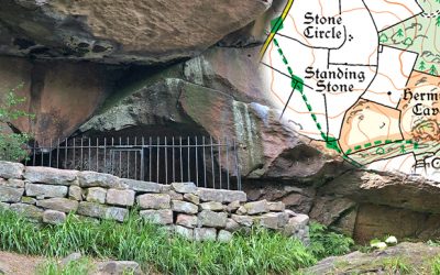
The recently-posted 14-mile walk from Bakewell to Robin Hood’s Stride passes a medieval hermit’s cave with a crude carving of the crucifixion dated to the late 14th century.
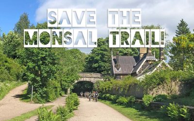
The last train ran along what today is the Monsal Trail in 1969. But calls for the reinstatement of the line to provide a public transport link between Buxton and Bakewell are gaining support.
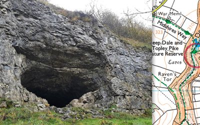
Thirst House Cave lies beside the path from King Sterndale across Deep Dale. It’s one of many similar caves in the White Peak’s limestone landscape where our ancient ancestors once found shelter.
A small electric train connecting the Monsal Trail with Buxton would greatly benefit this famous Georgian spa town, but the project seems to have come to a grinding halt because of a lack of funding.
Topley Pike Quarry lies close to the Buxton end of the Monsal Trail. Plans to return it to a nature reserve have been put on hold because of planning problems. Which is a great shame.

I decided it was time to promote this website to a wider audience by launching a Facebook Group. Otherwise it does start to feel like I’m talking to myself. And that’s never a good thing.
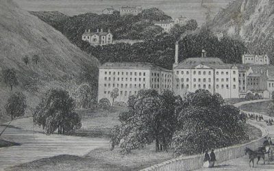
Cressbrook Mill escaped the fearful reputation of Litton Mill. But an eight-year-old girl snatched from a Bristol workhouse wrote a searing account of how ‘Tom the Devil’ ruled with a rod of iron.
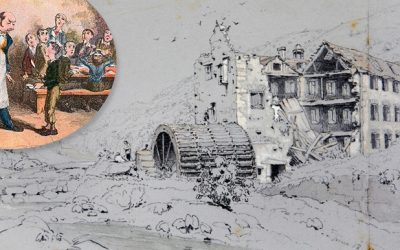
Litton Mill earned a brutal reputation for the exploitation and ill treatment of pauper orphans taken by force from the streets of cities as far away as London to work long hours in dangerous conditions.
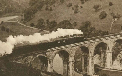
Victorian critic John Ruskin famously complained that Headstone Viaduct allowed “every fool in Buxton to be in Bakewell in half-an-hour”. Today we see it in a very different light.
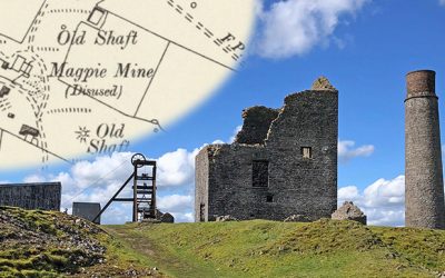
Magpie Mine was Derbyshire’s last lead mine, finally closing in 1953. It was the site of three murders in 1833, and a widow’s curse which foretold yet more deaths and accidents to come.
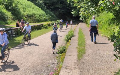
Today’s quiet and peaceful Monsal Trail once rang to the noisy sounds of steam engines running on one of the most important railway lines in the country, linking Manchester with London.
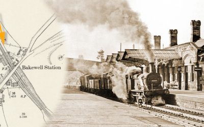
Bakewell Station played a vital part in the town’s prosperity and expansion, but it very nearly didn’t happen when the Duke of Rutland refused permission for it to pass close to Haddon Hall.
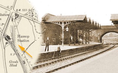
Hassop Station was built to the highest standards and included a first class waiting room designed to entice the Duke of Devonshire. But it was all to no effect as he preferred Rowsley!
Great Longstone Station was the third stop on Midland Railway’s extension from Bakewell to London and Buxton. It opened in 1863 and closed 99 years later in 1962; a victim of the Beeching cuts.
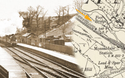
A stretch of platform is all that’s left of Monsal Dale Railway Station which lay on the Buxton side of Headstone Viaduct. It was the last of five stations to be built on this section of the line.
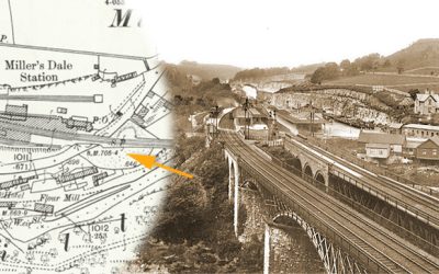
Set in typically scenic Peak District countryside, Miller’s Dale Station became an unlikely but important intercity hub in the heyday of steam travel on the route between London and Manchester.
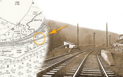
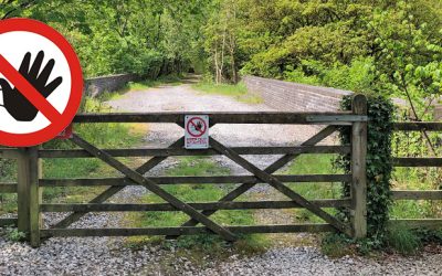
Blackwell Mill Halt was built for railway workers living in the cottages close to the start of today’s Monsal Trail. Recent plans for a light railway could mean it emerges once again from the undergrowth.
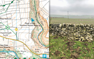
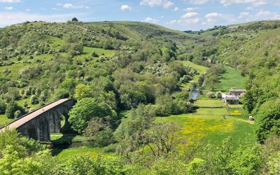
A recent walk along Monk’s Dale set me wondering whether medieval monks really did once live and work in this wonderfully tranquil spot, seeking to escape the cares of the world.
A journey of a thousand miles starts with a single step, according to Mao Zedong. This little website is probably not quite on the same scale, but at least I’ve now made a start.