Starting from the picture-postcard village of Ashford-in-the-Water, this 8-mile walk takes you beside the River Wye and through Deep Dale to the ruins of Magpie Mine – the scene of a triple murder.
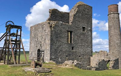
Starting from the picture-postcard village of Ashford-in-the-Water, this 8-mile walk takes you beside the River Wye and through Deep Dale to the ruins of Magpie Mine – the scene of a triple murder.
The biggest problem with the Trail is that it stops about three miles short of Buxton. But there is a 9-mile walk that will take you through two attractive dales to reach the famous Georgian spa town.
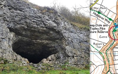
Thirst House Cave lies beside the path from King Sterndale across Deep Dale. It’s one of many similar caves in the White Peak’s limestone landscape where our ancient ancestors once found shelter.
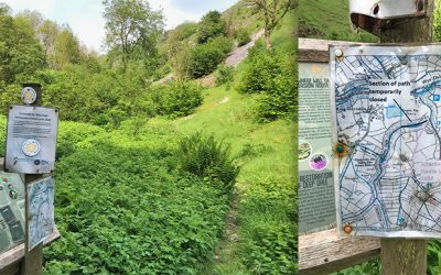
Topley Pike Quarry lies close to the Buxton end of the Monsal Trail. Plans to return it to a nature reserve have been put on hold because of planning problems. Which is a great shame.