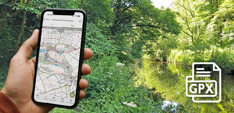
Above: Following the route of the Bakewell to Lathkill Dale walk using a GPX on a typical walking app.
An introduction to following a GPX route on a walking app, and some of the most popular apps available.
A detailed guide on how to upload and follow a GPX route using the OutdoorActive app.
View all the GPX files available on this website to follow any Monsal Trail walk.
I often come across people struggling to follow written instructions for a walk – either on a mobile or after printing them out. However detailed they are, it’s always easy to miss a narrow track, or misinterpret ‘diagonally left’ as a completely different direction.
My advice is always to use a walking app so you can immediately see if you’ve taken a wrong turn. There are quite a few available for both Apple and Android phones, and most have a free option, although paying a subscription often has many benefits.
Monsal Trail GPX library
All walking apps use GPX files to follow a route. GPX files are now available for all the walks featured on this website. I’ve made a nominal charge of just £1.50 to download a file which will go towards the ever-increasing costs of hosting this website. Click here to view and download any Monsal Trail GPX file.
Click here for a page explaining how a GPX file works, plus a comprison of some of the most popular apps available. And here for a step-by-step guide to installing and using a GPX file on my favourite walking app; OutdoorActive.