
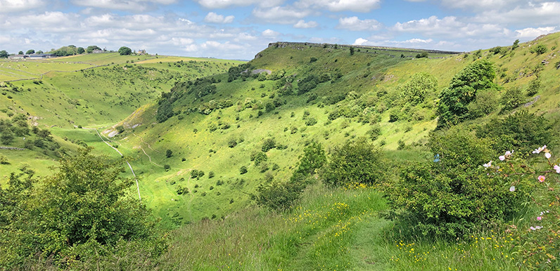
The view as you exit the higher path from Cressbrook Dale. The lower path emerges from the trees along the valley floor at bottom left.

Click for a pdf with stage-by-stage details of the route including photos and a map, as well as links to car parks and public transport. A walking app GPX file is also available.
Length: 7.9mls | Av. time: 3h 50m | Ascent: 1348ft
Start: Litton | Google Map
Walk description, map & GPX | Download
A 7.9-mile circular walk from the pretty village of Litton through two of the White Peak’s most scenic dales, Tideswell and Cressbrook. It passes two notorious cotton mills, and follows a stretch of the Trail past Monsal Dale Station.
There’s no car park in Litton, but on-street parking is usually easy to find near the Red Lion beside the village green. There’s also a small car park at Tideswell Dale (point 4 on the pdf map), and regular buses from Buxton, Bakewell and Tideswell – see getting there.
Tideswell Dale is short, picturesque and easy to walk through on well-made paths. It was once quarried for basalt, a volcanic rock used for road building.
Just before Litton Mill, the route crosses a small footbridge over the Wye and climbs to the Trail. Like nearby Cressbrook Mill, it earned a brutal reputation for ill-treating child workers in the 18th and 19th centuries.
Monsal Dale Station
The Trail then passes the remains of a platform – all that’s left of Monsal Dale Station – before crossing back over the Wye to the hamlet of Upperdale. It then passes the entrance to Cressbrook Mill to reach Cressbrook Dale.
At 2.5 miles end to end, Cressbrook Dale is much longer, with narrow tracks through woodland at its southern end before it opens into a wide valley. It was in the news when local residents led a successful campaign against plans by an ex-Dragons’ Den investor to create an ‘eco settlement’ on part of the dale.
From point 14 there are two routes through the dale – a higher one with wonderful panoramic views, which this walk follows, and a lower one along the rocky valley floor beside the stream, which avoids the climb but can get muddy.
You can also shorten the walk by crossing a small footbridge at point 18.

Above: Peter’s Stone is said to have gained its name because, from a distance, it has a similar shape to the dome of St Peter’s Basilica in Rome.
The distinctive limestone knoll stands at the northern end of Cressbrook Dale. The route doesn’t go up to it, but it’s a short detour from the path at point 19.
Peter’s Stone has a gruesome history as the site of Derbyshire’s last gibbet, where the bodies of executed men were left to rot in an iron cage hung from its side (view a good explanation).
The scenic route
From here it’s a short walk up the other side of the valley to the road into Litton. But rather than walk along a road with no pavement, the route takes a more scenic path around the edge of the gorge.
Back in Litton there’s a small shop serving drinks and snacks, and the popular Red Lion has benches on the village green and a good range of drinks and meals.
Click for a pdf with stage-by-stage details of the route including photos and a map, as well as links to car parks and public transport. A walking app GPX file is also available.
Route photos
Stages 1-6 of the route. Click any to enlarge and scroll through.
Relive video
Click to play and use the expand option to view in full-screen. More Monsal Trail Relives.