

Click for a pdf with stage-by-stage details of the route including photos and a map, as well as links to car parks and public transport. A walking app GPX file is also available.
Length: 7.3mls | Av. time: 3h 15m | Ascent: 860ft
Start: Miller’s Dale Station | Google Map
Walk description, map & GPX | Download
A 7.3-mile circular walk from Miller’s Dale Station. It follows the Monsal Trail towards Bakewell, drops down to cross the River Wye near Litton Mill, then climbs through Tideswell Dale towards Tideswell, returning via Wormhill and the river.
The station has a large car park, a popular cafe and toilets. Alternatives are the small car park on the B6049 at Tideswell Dale (point 7 on the pdf map) or on-street parking in Tideswell. For buses, see getting there.
The Trail crosses the older of the two viaducts at Miller’s Dale, built in 1862 – the second was added in 1906 to cope with the growing number of trains. Further on, a display board explains the geology of Litton Cutting.
The lane beside the Wye would once have been used to bring orphans to work at Litton Mill. Dickens is said to have based Oliver Twist on the memoir of a boy forced to work there in cruel and dangerous conditions.

Above: The boulder behind the information board (inset) is known as a ‘pillow’ and was formed when an ancient lava flow entered the sea.
The limestone revealed when railway workers blasted through the cutting dates back some 330 million years. It was formed from the remains of shelly creatures that swam in a warm sea covering most of Britain.
Tideswell and Wormhill
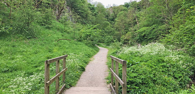
From the footbridge over the Wye, the route enters Tideswell Dale – pictured at the top of the page – before heading north towards Tideswell.
The walk doesn’t go into the town centre, with its impressive ‘Cathedral of the Peak’ church, but it’s only a 10-minute stroll along Queen Street from point 11, with a choice of pubs and cafes.
The return crosses fields, lanes and farm tracks to Wormhill, with benches by the church porch and an attractive village green, before dropping down to the river to rejoin the Trail.
Near the end is an impressive lime kiln which, from 1880 until 1944, produced over 50 tonnes of quicklime a day, sent across the country by rail.
Click for a pdf with stage-by-stage details of the route including photos and a map, as well as links to car parks and public transport. A walking app GPX file is also available.
Route photos
Stages 1-6 of the route. Click any to enlarge and scroll through.
Relive video
Click to play and use the expand option to view in full-screen. More Monsal Trail Relives.