

Click for a pdf with stage-by-stage details of the route including photos and a map, as well as links to car parks and public transport. A walking app GPX file is also available.
Length: 6.2mls | Av. time: 2h 50m | Ascent: 945ft
Start: Monsal Head | Google Map
Walk description, map & GPX | Download
A 6.2-mile circular walk from Monsal Head up to the high point of Longstone Moor, with wonderful panoramic views. It heads east along Longstone Edge, then drops down farm tracks and old packhorse lanes to Great Longstone, returning along the Monsal Trail.
There’s a large pay and display car park at Monsal Head, and if you arrive early you can often find free spaces along the lane to Little Longstone. Monsal Head is on a regular bus route – see getting there.
Monsal Head overlooks the River Wye as it passes beneath Headstone Viaduct and winds through Monsal Dale. The route heads through Little Longstone, past the Packhorse Inn, before climbing to the moor.
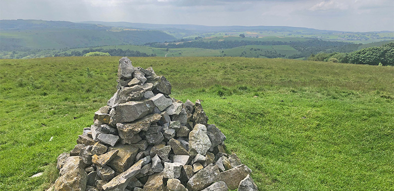
The cairn at the top (point 11 on the pdf map) marks a Bronze Age burial mound, some 4,400 years old. The views stretch for miles, which is probably why our ancestors chose this spot to bury their honoured dead.
There are more tombs close by, and two other important ancient sites can be seen from the cairn – Fin Cop and Five Wells Chambered Cairn.

Above: The view along Hardrake Lane as it approaches Great Longstone.
The walk also passes several long ditches known as ‘rakes’ – the remains of opencast lead mines. Derbyshire has been an important source of lead since before Roman times, generating vast wealth for local landowners such as the Duke of Devonshire.
Great Longstone and the Trail
Great Longstone has two pubs, the White Lion and the Crispin. The route then joins the Trail at the old station and heads back through Headstone Tunnel – the longest on the Trail – and over the viaduct.
A short detour left, under the bridge at the station, brings you to Thornbridge Hall’s ‘Quackers Cafe’, with a children’s play area. Back at Monsal Head there’s the Monsal Head Hotel and Stables, and Hobbs Cafe.
Click for a pdf with stage-by-stage details of the route including photos and a map, as well as links to car parks and public transport. A walking app GPX file is also available.
Route photos
Stages 1-6 of the route. Click any to enlarge and scroll through.
Relive video
Click to play and use the expand option to view in full-screen. More Monsal Trail Relives.